Monday, April 23, 2012

Week 11: Georeferencing Student Spotlights

Georeferencing Lab Overview: 

In previous labs, students found, obtained, and viewed several types of GIS dataset formats. Each of these datasets had been created by someone specifically for a GIS system complete with geographically referenced coordinate data built in to the file. This is why, when you add data to ArcMap, it (usually) lines up properly automatically. The Georeferencing lab teaches students a method of adding this geographic referencing to a dataset (georeferencing), and how to create some types of new geographic data.

Objectives:

  • Utilize ArcGIS tools to georeference aerial photographs
  • Demonstrate the Editing skills learned last week
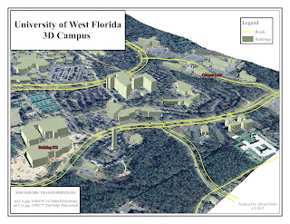
  • Discover ArcScene and produce a 3D map

Congratulations to this week's Student Spotlights!

Jennifer Tryggestad 

Jennifer currently lives in New Jersey and works for an ocean surveying company. She is a new mom and hopes that by obtaining her GIS certificate she can travel less
and manage more. We hear ya!
What we like: Very nice map design and nice building labels.
More:  see Jenny's blog

Sandie Vechio 


Sandi lives in Arizona and has a BA degree in Advertising/Journalism.  She chose the GIS program help her re-enter the work force since her children are in high school.  Her interests include GIS in real estate and demographics.  Just you wait – Sandi.  Applications and Internship are full of information.  Great job!  
What we like: Clean and well laid out map.
More:  see Sandie's blog


Bryan Hollis


Bryan is a New Hampshire native and spent a year working on an off shore oil rig in the Gulf of Mexico.  He’s back on land and utilizing GIS on a daily basis at his current position.  Bryan has never had an official GIS training, but he is doing a great job so far.  Check out his 3D model!

What we like: Very nice map - we like the view, colors and labels.
More: see Bryan's blog


Christopher Mullins

Chris just finished nine years of active duty with the Navy and currently lives in Augusta, GA where he works as an intel analyst contracting for the government.  He has always been interested in the GIS aspect of the intel community and getting a GIS certificate would definitely help his career progression.  He’s the proud dad of a toddler and is doing a great job balancing work, the program, and his little girl.  Awesome job Chris!

What we like: One of his best, we like the color choices and how easy details read.
More: see Christopher's blog

Michael Supranowicz

Mike lives in Chesire, Massachustets with his wife and cat.  He works for the chamber of commerce and is excited about the endless possibilities of GIS and business development.  Awesome job this semester Mike!


What we like: Nice angle/view and map layout!
More:  see Mike's blog

Friday, April 20, 2012

Week 10 Data Editing Student Spotlights

This week, learned how to modify existing data and create new features in an existing dataset. These Editing Sessions are powerful tools in GIS, and a bulk of the day-to-day work of GIS professionals.

Exercise Objectives:
  • Merge two parcels into one feature
  • Select parcels based on certain criteria
  • Update a road feature’s geometry to match surroundings
  • Digitize a new road feature
  • Create map of up-to-date features

Cograts to this week's Student Spotlights!


Roger Huron 

Roger recently completed the US Marine Corps and is currently employed by the United States Department of Justice.  He became interested in GIS after his wife (a geography major) took a GIS class.  Welcome to the spotlight, Roger! 

What we like: Really detailed map design. Data frames are a nice touch.
More: see Roger's blog.

.

Kira Kefer

 
Kira lives in Idaho and works as a staff assistant for an engineering consulting firm.  She chose the GIS Certificate as a way to enhance her career.  When not at her computer, Kira enjoys outdoor activities like fishing and bow hunting.  Oh, and don’t forget about hockey – Go Sun Valley Suns!

What we like: Really nice map inset and good use of symbology tools.
More: see Kira's blog


Collier Kidd 

Collier is from a small town in SW Georgia and works as a forestry technician in Albany, Georgia.  He is on the road to obtaining his GISP certification and is the proud dad of an almost two year old.  Great job this semester, Collier! 

What we like: One of Collier's best maps this semester. Easy to interpret map.
More: see Collier's blog.


Gabrielle Johnson 

Gabby is a senior here at UWF majoring in Environmental Studies.  She lives in Ft. Walton Beach and when not at school or mastering GIS at home, she can be found with her daughter Bella or at the beach.  Anyone with a coastal GIS project? – Gabby is your answer.  Nice job!

What we like: This is her best map this semester!
More: see Gabby's blog.

Robert Josey


What we like: Nice placement of data and color choices. Map layout is clean.
More:  see Robert's blog.


John Kearney 

 John lives in Perry, Florida with his wife and is employed as a fire fighter/ forest ranger for the Florida Forestry Service.  He is a graduate of UCF (University of Central Florida) and became interested in GIS while managing over 800 acres of land.  Awesome job in the program and for the environment!  We appreciate all that you do! 

What we like: Really nice design and layout
More:   see John's blog.

Sunday, April 15, 2012

Week 9 Vector Part II Student Spotlights

Did we skip a week? Yes, we did. Since students didn't create a visual output with Vector Part I and skills learned in Part I lead to Part II... decided to wait.

In Vector Part II, students completed the following objectives to create a final output the following students executed superbly.

Exercise Objectives:
  • Create a simple buffer around road features
  • Create a variable distance buffer around water features
  • Run the buffer tool using ArcPython
  • Run the overlay tool to combine or exclude multiple features
  • Distinguish and convert between multipart and singlepart layers
  • Find potential sites for a new campground

Alison Hayden 

Alison is a (recently retired) pro-triathlete of 16 years and a Marine Biologist/Oceanographer who has spent most of her career working in the field and mostly within the Gulf of Mexico."I am pursuing GIS in hopes of making my career as a Marine Biologist more practical." In her spare time, she loves traveling to exotic places, playing in the ocean and enjoys many types of exercise.

What we like:  Map layout - gray background makes information "pop."
More: See Alison's blog

Allen McLaughlin  

Allen is currently finishing up a double bachelors degree in Maritime Studies and Environmental Science.  Allen has an intense background in mapping, terrain modeling, and navigation he learned and used in the U.S. Army.  "I've used everything from dirt, sticks, string, hand grenade pins, bullets, parachute canvas, food, and even spit to create terrain models and field expedient maps in order to survive."  Allen plans on gaining a good working knowledge with ArcGIS in hopes to one day changing careers  to one involving the use of GIS.


What we like: Clean and easy to interpret map. Good color choices. Notes section including relevant art.

 More: See his Vector 2 blog post


Georgia Mass 

Georgia is new to GIS, but you wouldn't think it from the high-caliber of work she produces on a weekly basis!  When she isn't occupied with course work, Georgia stays busy as a Navy wife with 4 children.


What we like
: What a fun map! Good choice of colors, nice layout and  road labels are a bonus. 
More: See Georgia's blog


Karen Matthews

Meet Karen: "When I'm not the single mom to my 13 yr. old daughter, I'm a GA attorney doing real estate.  The real estate closing business has really changed in the last 5 years. We have gone from office closings to home closings. In the last 5 years, I've completed over 2700 transactions, burned up 2 cars and 400k miles. I'm ready for a real change." Karen is increasing her skill set with GIS to better serve her clients and to increase her marketability. Being new to GIS,  Karen has done an exceptional job picking up on the science and software in these past few months.  I'm excited to see what she can accomplish in this program with the basics under her belt.
What we like: Nice map layout, colors are easy on the eye with the main focus of campsites made obvious with a strong color, inclusion of conservation sites a bonus. 
More: See Karen's blog.


Katherine Michael

Welcome back, Katherine! Katherine does exceptional work in this class and with GIS. If you aren't following her blog - please do.

What we like:  Clean map design, layout and color choices (something Katherine executes well with all of her maps). Shadow effect on legend, data frame and notes section.


More: See Katherine's' blog

Ross Wachendorf 

 Ross moved Texas to become a Geographic Analyst for Nokia (formally Navteq) a little over a year ago. "We use our own propriety software and methods of operation, which is why I am taking this coarse in order to learn industry standard GIS methods." For a bit of background, Ross started working with Nokia three years ago driving data collection vehicles throughout the U.S. collecting street level images - cool! 
What we like: Colors, hill shading, simple map layout and road labels are a bonus. 
More: See Ross' blog.

Monday, April 9, 2012

Week 7 Data Search Student Spotlights

In this lab, students were required to download data from three online sources and to create 1-3 maps that best represent the data on their own with little instruction. Defining a common projection, getting all data layers to "fit" and determining the best way to present the data were no doubt the biggest obstacles students faced. All of our students did great job tackling this project and the following students excelled. 

Congrats to this week's Student Spotlights!


Alex Fowlkes  


 Alex impresses us on a weekly basis with his work.  This is his second time making the spotlight and it's well deserved. Take a look at his blog to see why.
 
What we like: Excellent map design... glowing even.


M. Magdy Hussain

Magdy produces great work consistently.  You'll find his maps to be accurate, clean and easy to interpret. Yes, this means if you aren't already following his blog, you definitely should. Welcome back, Magdy!

What we like: Magdy probably split the data over three maps the best of all. Data is presented clearly.  Labels and legends are easy to view as well. As Tanya put it, superb.


Shane Smith

Shane is another one of our students who produces excellent maps on a weekly basis. If you aren't already following his blog - yup, you should. Welcome back, Shane!  

What we like: We really like the map layouts in this series. The colors and placement of elements are well chosen and balanced. This particular map has great detail.


Shannon Riley


Shannon is a Government Emergency Specialist, a Command Post Controller with the Air Force and a mom. She's used GIS to map national security incidents and weather phenomena to provide situational awareness to key military personnel. I'm excited to include Shannon in this week's student spotlight line-up.


What we like: Easy to interpret maps with everything we were looking for. I like that Shannon chose to use classic black and white for elevation in Suwanee. She added the correct units to her DEM! For some reason, not many students got this part right... but, who am I kidding? We excite easily :)
Brian's background is in IT and communications electronics in the Air Force.  His current job in Midland, TX is with a seismic exploration company in the oil and gas industry and the survey/mapping department. Welcome to the spotlight, Brian!


What we like: Good job of presenting environmental themed data in a single map.