Module #5: Georeferencing
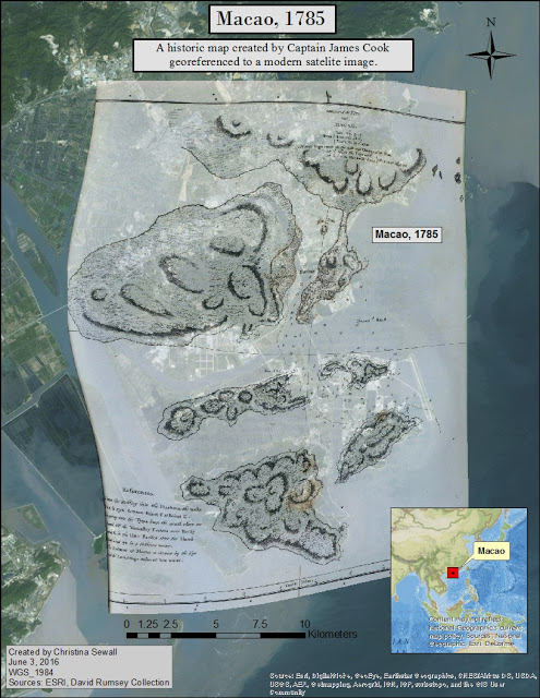
In Module 5, students were tasked with locating historic maps from online sources and importing them into a GIS framework. While the primary focus was identifying levels of georeferencing accuracy and factors that may influence results, this lab also included identifying biases and geographic inaccuracies in the early map documents. The final deliverable was required to include the georeferenced historic maps along with current aerial imagery. It is our hope that students can use these skills to create map documents that will help facilitate modern archaeological research, create compelling results, and enhance their reporting skills for their future research.This week's STUDENT SPOTLIGHT AWARD goes to... Christina Sewall! Welcome to the Spotlight!
Scott Palumbo, the course instructor, writes: "I chose this lab because her historic map was accurately georeferenced, and because she made good use of her title and mini data frame to provide context to the assignment. Additionally, her blog discussion made it clear how the image was georeferenced, and why such a task might matter to an archaeologist."
Follow Christina's progress at her student blog: http://chrisgisuwf.blogspot.com/

No comments:
Post a Comment
Note: Only a member of this blog may post a comment.